UIGH
- Total Area - 58,698 Km2
- Population - 1,426,354
- Temperature - 24°C
- Climate – Wet Tropical
- 16 Municipalities
Meet Uíge
Uíge is a province of Angola with an area of 58 698 km² and its population is approximately 1.4 million inhabitants.
It is located in the far north of the country, and its borders are to the north and east, with the Democratic Republic of Congo, to the southeast, with the province of Malanje, to the south with the provinces of Kwanza Norte and Bengo, and to the west, with the province of Zaire.
It consists of 16 municipalities:
- ambulance
- wellbe
- buengas
- Bungo
- Damba
- Alto Cauale
- mockup of Zombo
- milunga
- Mucaba
- Negage
- Puri
- Quimbele
- Kitchenette
- Sanza Pigeon
- Songo
- Uíge
Luanda is around 345 km away and M'Banza Congo is 314 km away.
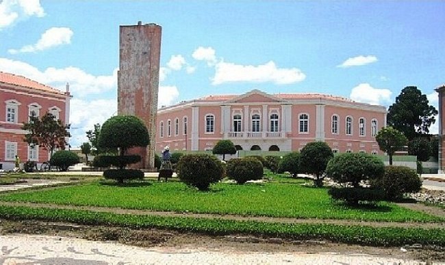
The provincial capital is also called Uíge. In 1955 Vila do Uíge was renamed Vila Marechal Carmona, in honor of the former Portuguese president Óscar Carmona, keeping the district of which it was headquartered under the name Uíge. After being elevated to a city, it was called simply Carmona. In 1975, it regained the original name of Uíge.
Climate
The climate is humid tropical with an average annual temperature of 24ºC. As for the seasons, it is only possible to distinguish two: the hot, rainy weather, which lasts from September to May, and the one from June to August, the cacimbo period.
Hits
Uíge has 2 airports, one in the city of Uíge and the other in Negage.
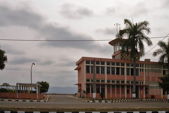
Airport in the city of Uige
From Luanda, it is possible to arrive by road crossing the province of Bengo.
Population
The most spoken language is Kicongo and the ethnic groups are mostly Bakongo, Kimbundu and Ovimbundo.
Economy
Agriculture and commerce are the important sectors in Uíge, which was once considered the Angolan coffee 'capital'.
Uíge's climate is hot, which is why it favors the cultivation of coffee, cassava, oil palm, peanuts, sweet potatoes, beans, cocoa, sisal and others on a smaller scale.
Livestock, in relation to cattle, pigs and goats, is carried out throughout the territory, mainly in the municipalities of Negage, Bungo, Alto Cauale, Puri Kangola, Sanza Pombo, Songo, Damba and Maquela do Zombo. In the municipalities of Uíge and Negage poultry farming stands out.
In fish farming there is a total area of 217,400m2 in the municipalities of Uíge and Negage. Artisanal fishing is carried out along the Cuango River, in the municipality of Quimbele.
Mineral resources are copper, cobalt, limestone, sulfur and dolomite, talc and zinc.
Currently, the province is beginning to exploit the woods of the dense tropical forest that occupies a large part of the region.
In the province, reed baskets, chairs and baskets are produced. The products are sold in markets, mainly in Quimbele.
Nature
The territory has large forest patches and is heavily wooded. The coffee-growing regions of Negage, Quitexe, and Damba are typical, occupying large extensions of thick forests with trees for cutting wood. The Municipalities of Milunga, Quimbele and Buengas are also important wood producers.
In the Beu forest reserve, the vegetation is of the mosaic type, dense forest. You can find the riverside vegetation in Muxito, Periguine, in alluviums, woods and savannas. The reserve is limited to the north by the border with the Democratic Republic of Congo, to the west by the river Zadi, to the east by the river Beu, to the south by the commune of Beu.
 Uíge Province is a region of abundant hunting, in general, there is everywhere a little of each animal species including the elephant that can be found in herds on the banks of the Loge, Coge, Lucunga and Cuilo rivers.
In its fauna we find animals such as elephants, buffaloes, wild pigs, antelopes, blue monkeys and even several rare species.
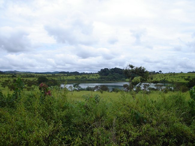
Uíge has a hydrographic basin that we can call medium-sized, as there are rivers of great flow. The most important rivers in this province are the Zadi, Dange, Luria, Lucala and Luvulu. In general, these rivers are navigable by small boats up to 20 kilometers from the mouth, and sport fishing is also possible.
Uíge Province is a very rugged region, not differing much from the country's general characteristics.
extension consists of large mountainous areas.
- Plateau, consisting mainly of the basin of the sub-tributaries of the Zaire River, whose waters flow to the north. This area is undulating, but with deep ravines, especially in rivers with greater flow, however, it is not navigable in its entirety;
- Area of the Mbrige River Basin, which lies southwest of the Pete-Mucaba-Songo-Mabaia line. This area is also undulating and with deep ravines; by the rivers, low and little undulating;
- Mountainous area, which covers the interior of the province, especially the Loge and Dange rivers, as well as the tributary basins.
In this region, the following mountains stand out, which constitute the dividing line of the most important hydrographic basins in the Uíge Province:
- brown
- Luege
- Ambulila
- calambinga
- Quitoque
- pingano
- Camanga
- huge
- Mucaba
- Toto Lefunde
- massarelo
- Quimbumba
to visit
The province of Uíge has natural beauty and numerous historical sites to visit:
- Bombo Falls over Cuilo River
- Massau Falls;
- Camulungo Falls;
- Sorcery Pond
- Lagoa de Luzamba
- Mavoio Lagoon
- Sacapete Lagoon
- Loge Valley
- Hills of Alto Caual
- Stone of N'Zinga N'Zambi
- Kakula Quimanga Stone
- Pedra do Tunda is located in the Negage
- Beu Forest Reserve, with an area of 1,400 km². The vegetation is mosaic type, dense forest. The reserve is limited to the north by the border with the Democratic Republic of Congo, to the west by the Zadi river, to the east by the Beu river, and to the south by the Beu commune.
- Former Administration of the Municipality
- Old State Houses
- Busto do Heroi N`bemba; it is at the entrance to the N'Bemba N'Gango neighborhood, in Uíge, and was a chief of the city
- Church of São José, next to the stones of Encoje, dating from the 18th century
- Fortaleza do Bembe, built in the 20th century, is located next to the church of S.José
- Rock figures of Kisadi
- Cave Paintings of Kabbalah
- Magic Bridge over the Vamba Wa Mbamba River
- Ruin of Maquela's Fort
- Tomb of Elder Mekabango, great warrior in the resistance against colonial occupation
- Tomb of the Great King Mbianda-Ngunga, warrior of the resistance to the occupation
Parties
The City festivals take place from the 1st to the 7th of July, throughout the province.
Gastronomy
The typical dishes are muambas, nthsombe (a species of larvae caught in trees, cooked and toasted) and catatos, accompanied by funge or vegetables. The typical drink is Malavo (or marufo), taken from the tree called bordão.